Hiking Arthur’s Seat, Edinburgh’s extinct volcano
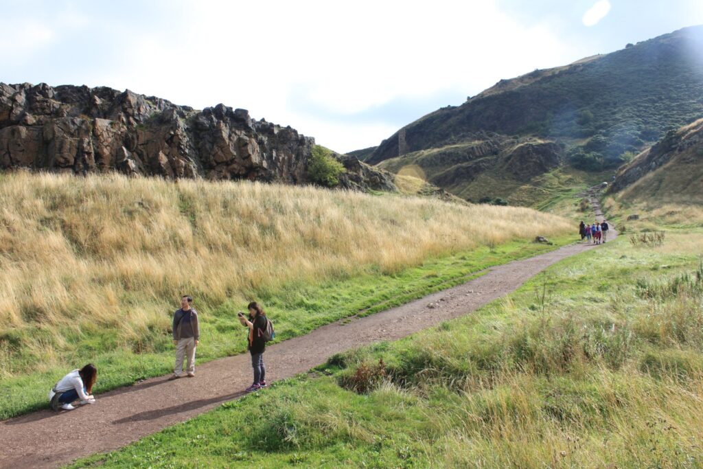
This summer me and my girl went to Edinburgh for the Fringe Festival with some city exploring on the side. We’re squeezing through the crowds on the Royal Mile, caught some shows and had some good food and drinks. Her parents were visiting the UK as well from Taiwan and we wanted to meet up and see some more of the city. One of the things we did was climb a volcano.
And the weather was on our side. Sunshine, a few clouds drifting over, and the long grass on the slopes has gone all golden. In Scotland, you take a day like that and run with it as the previous days it had been on and off with rain and sunshine.
The route
Arthur’s Seat is in Holyrood Park, which starts exactly where the Royal Mile ends, all the way down the hill. No need for a car, bus, just walk down. We walked past the Scottish Parliament and the gates of the Palace of Holyroodhouse, and the city just… stoped. There’s a road, a lot of grass, and the cliffs of Salisbury Crags rising up in front of us like a wall.
There are lots of ways up. We took the one I’d suggest to anyone going for the first time, because it strings the best bits together: St Margaret’s Well, St Anthony’s Chapel and then the summit.
St Margaret’s Well
We crossed Queen’s Drive and followed the path along the foot of the hill towards St Margaret’s Loch. Within a few minutes we passed St Margaret’s Well. It’s a small stone well house set into the slope, with a metal grate over the entrance. Peer through it and there’s a vaulted ceiling resting on a single pillar, and water dribbling out of a carved stone face. People toss coins in, like it’s a wishing well.
Here’s the funny part: it isn’t from here. The well house was built in the 15th century in Restalrig, a couple of kilometres away. Around 1860 the North British Railway wanted to build a depot right on top of it, so the Society of Antiquaries of Scotland took it apart stone by stone and rebuilt it here, over a spring. So one of the oldest things on this walk only moved into the park in Victorian times.
St Margaret’s Loch and St Anthony’s Chapel
A bit further on is St Margaret’s Loch. It looks like it’s been there forever, but it was only made in 1856, as part of Prince Albert’s makeover of the park. On the rocky ledge above it stands what’s left of St Anthony’s Chapel: a jagged bit of stone wall against the sky.
The short path up to the chapel is steep enough to make any conversation go quiet for a minute. Then you turn around, the view opens up over the loch, Leith and the Firth of Forth, and suddenly everyone has plenty to say again.
Nobody really knows who built the chapel, or why. It’s first mentioned in 1426, when the Pope gave money to repair it, so it was already standing by then. It may have belonged to Holyrood Abbey down below, or had something to do with St Anthony’s hospital in Leith. Some say a light burned in it to guide ships into the Forth. I’m not sure anyone can prove that, but standing up here, it makes sense. After the Reformation it fell apart, and it’s been a ruin with a very nice view ever since.
Up to the summit
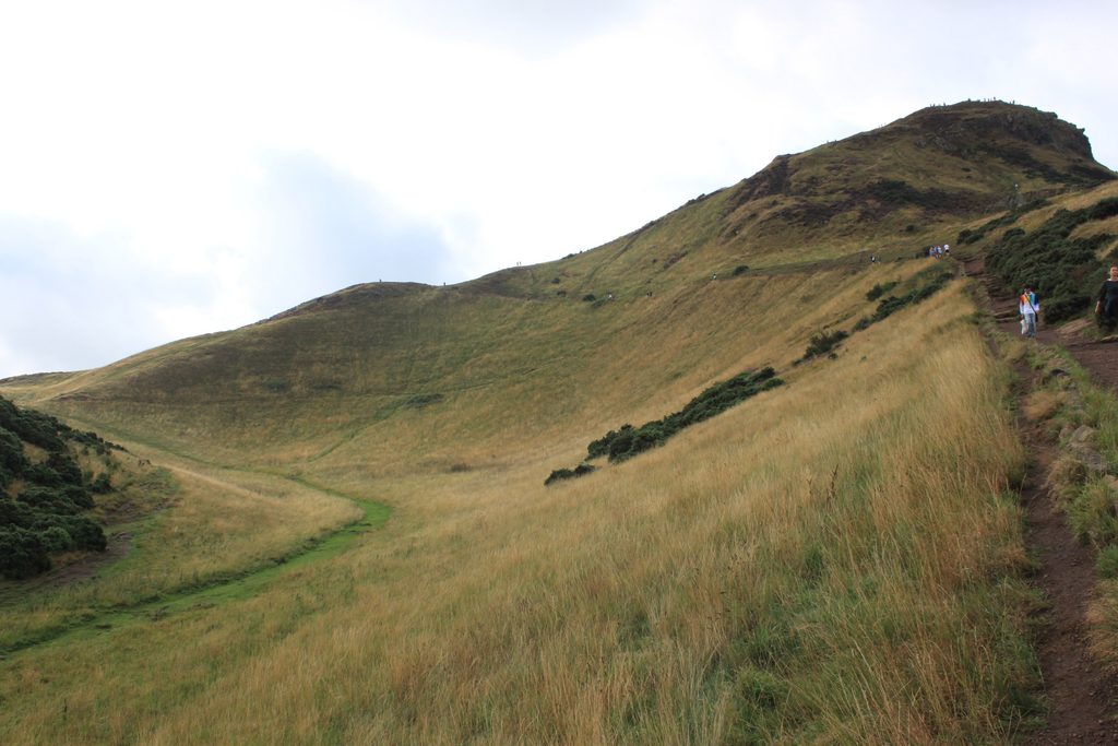
From the chapel the path heads up the valley beside Whinny Hill, and this is where it starts to feel like a proper hike. The grass gets thinner, the path gets steeper, and the last part to the top is all rock. That rock has been polished smooth by an awful lot of shoes. In the sun it grips fine. In the rain it’s like walking on soap. Take your time, use your hands if you want to, and don’t worry about who gets there first.
And then we’re on top. 251 metres. On paper, that’s nothing. But we started not far above sea level, the whole city is spread out at our feet, and up here the wind always seems to find you. It feels a lot higher than it is.
The view from the top
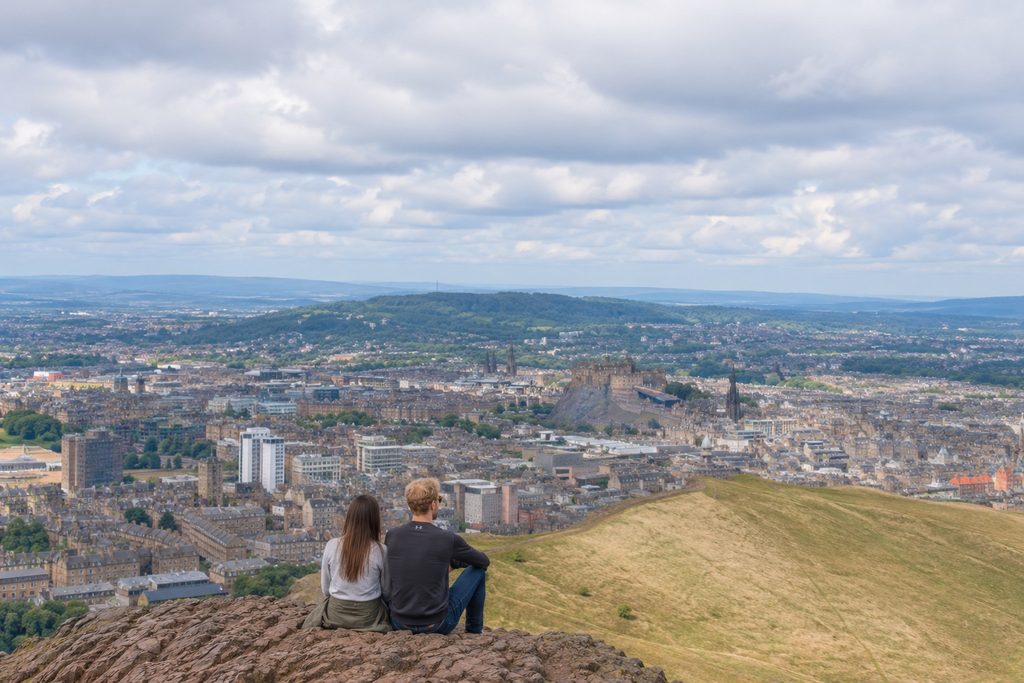
With the sun out and only a few clouds around, we could see pretty much all of Edinburgh in one go. There’s the castle on its rock, and the Old Town tumbling down the Royal Mile we just walked. Calton Hill, with its unfinished Greek temple. Turn around and there’s the Firth of Forth, Leith, the long sandy beach at Portobello and Fife across the water. To the south are the Pentland Hills, and on a really clear day you can pick out the Bass Rock and North Berwick Law out to the east.
Right below us is Duddingston Loch, and the Palace and the Parliament look like toys. It’s one of those views that makes you want to point at everything.
A volcano in the middle of the city
Here’s the bit that gets me. We’re standing on a volcano. People often call it dormant, but geologists would gently correct you: it’s extinct, and has been for a very, very long time. It erupted roughly 340 million years ago, in the Carboniferous period, when the rocks that are now Scotland sat somewhere near the equator. That’s more than 100 million years before the first dinosaurs.
And it wasn’t one big bang. The volcano poured out more than twenty separate lava flows, with layers of ash in between, and a lot of the hill we’re walking on is made of them.

Reading the rocks along the route
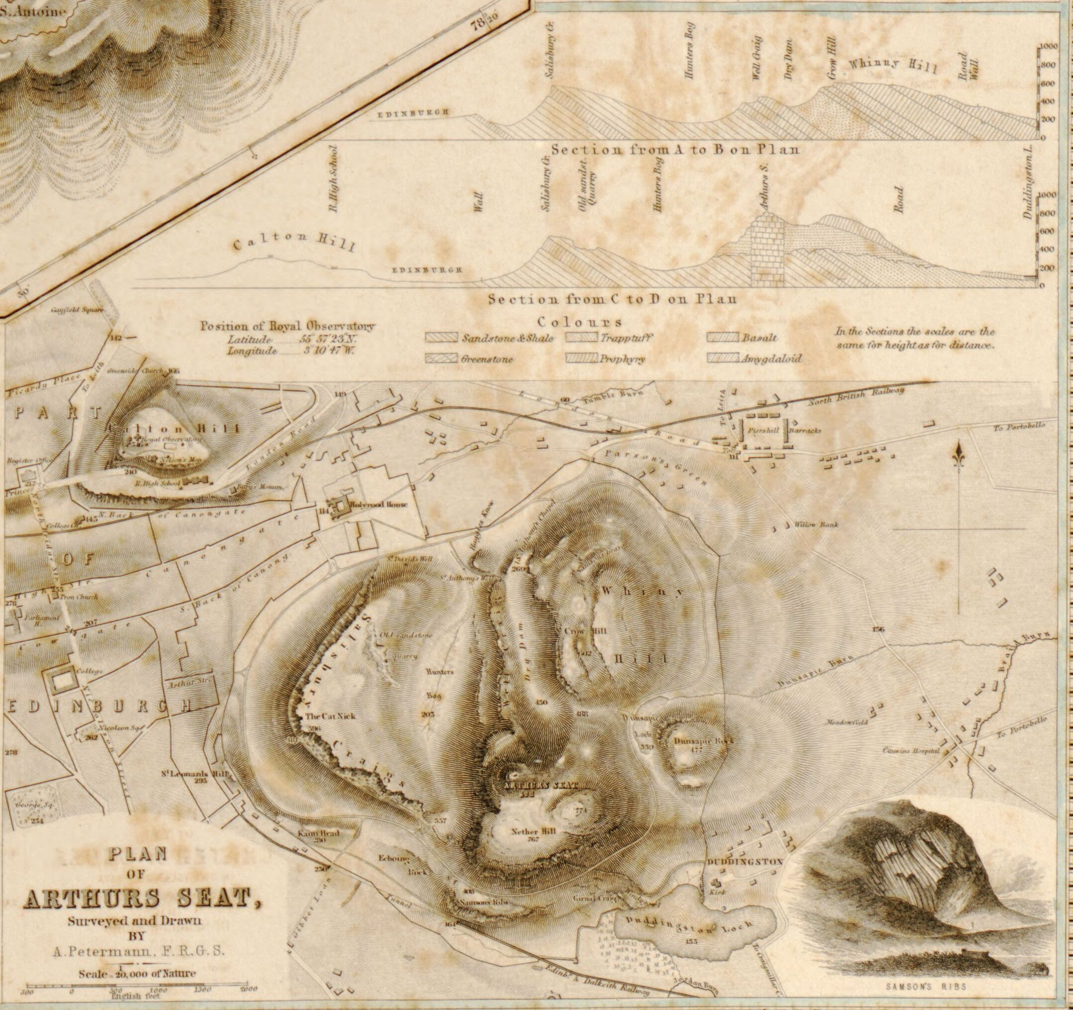
Once you know what to look for, the route reads like a story written in stone. And it starts before the volcano even existed.
Right at the start, at the north end of Salisbury Crags, the old Camstone Quarry shows layers of red-brown sandstone and grey mudstone. On the fallen blocks you can find ripple marks, just like the ones on a beach at low tide, and cracks where mud dried out in the sun. Back then this was a swampy, fairly dry landscape full of shallow lagoons. The same kind of rock lies under much of Edinburgh.
Salisbury Crags itself came later. It’s dolerite: molten rock that never made it to the surface, but squeezed sideways between the layers of sandstone underground and cooled there into a thick, hard sheet. Later still, the whole lot was tilted, which is why the top of the crags slopes away to the east.
That’s exactly what caught James Hutton’s eye. In the 18th century this Edinburgh geologist studied the bottom of the crags and saw how the dolerite had forced its way into the older layers, buckling them as it went. It became part of his argument that the Earth was much, much older than anyone thought at the time. The spot is still known as Hutton’s Section.
St Anthony’s Chapel stands on the very first lava flow. Underneath it is dark basalt, cracked into rough columns as it cooled, sitting on a layer of greenish volcanic ash. In that ash, geologists have found plant remains and blackened fragments that are probably burnt wood. Now look at the chapel walls. They’re built from chunks of that same basalt, with sandstone around the windows and arches. The chapel is literally made of the volcano it stands on.
As the path climbs beside Whinny Hill, we’re walking past more of those lava flows, stacked on top of each other like the layers of a cake.
And at the top, we’re standing in the throat of the volcano. The summit is part of the central vent, filled with volcanic breccia: broken chunks of basalt and lumps of lava that were thrown out as volcanic bombs, all jammed together. Together with the Lion’s Head and the Lion’s Haunch, the two humps that make the hill look like a crouching lion from the west, it’s the core of the old volcano. The cone that once stood over it is long gone.
If you come down on the south side of the hill, look out for Samson’s Ribs: a cliff of tall, many-sided basalt columns. There, the lava pooled in a hollow and cooled slowly, and slow cooling is what makes those neat columns.
Want to see exactly which rock sits where? The British Geological Survey has a great walking tour of Arthur’s Seat’s geology, with a geology map of the park. And the Scottish Geology Trust’s Arthur’s Seat Volcano page has the Edinburgh Geological Society’s map, plus photos of most of the spots above.
Then the ice came
What we see today was shaped last of all. Over millions of years, erosion stripped away hundreds of metres of rock, including almost all of the cone. Then came the ice ages. During the last big one, roughly 31,000 to 16,000 years ago, ice from the Highlands and the Southern Uplands flowed east across Edinburgh. It scraped away the softer rock and left the hard volcanic stuff standing. That’s a big part of why Salisbury Crags is a sheer cliff on the city side, and the ice squeezing around the hill scooped out the hollow that now holds Duddingston Loch.
Edinburgh Castle sits on a volcanic rock from around the same time, and as the ice flowed past it, it left a long “tail” of rock and debris behind. The Royal Mile runs right down that tail. So even the street we walked down to get here is part of the story.
Forts, legends and tiny coffins
People have been coming up here for a very long time. There are remains of Iron Age hill forts on and around the hill. And the name? Nobody’s sure. It might be one of the many places in Britain linked to King Arthur, and a poem from 1508 already calls it “Arthurissete”. Beyond that, it’s guesswork.
Two more odd stories before we head down. In 1836, five boys found seventeen tiny coffins hidden in a small cave on the hill, each with a little carved wooden figure inside. Nobody knows who made them or why. Witchcraft has been suggested, and so has a kind of memorial to the victims of Burke and Hare, who murdered people in Edinburgh in the late 1820s and sold their bodies for dissection. The coffins that survived are on display at the National Museum of Scotland.
And traditionally, young women from Edinburgh climbed the hill on May Day morning to wash their faces in the dew, because it was supposed to make them more beautiful. Some still do.
Good to know before you go
How long does it take?
From the bottom of the Royal Mile to the summit and back, via St Margaret’s Well and St Anthony’s Chapel, is roughly 4 to 5 kilometres, with a bit over 200 metres of climbing. Most people get to the top in 45 minutes to an hour. Count on 1.5 to 2 hours for the whole thing, or more if you stop at every viewpoint. (You will.)
How hard is it?
Easy to moderate. There’s no real scrambling, and plenty of people go up in trainers. But it’s steep in places, the top is rocky and uneven, and it’s properly windy up there. If you can manage a few flights of stairs without needing a lie-down, you’ll be fine. Just walk at the pace of the slowest person in your group and nobody has a bad time.
Best time to go
Early morning, if you can drag yourself out of bed. It’s quieter, the light is soft, and you get to watch the city wake up below you. Sunset is beautiful too, but in summer the sun sets late, well after 8pm in August, and half of Edinburgh has the same idea. And in August the whole city is packed anyway.
Whatever time of year you go, pick a dry day if you can. The polished rock near the top gets slippery in the rain, and when the haar, the cold sea fog, rolls in off the Forth, the view can vanish completely.
What to bring
- Shoes with decent grip. Trainers are fine when it’s dry, walking shoes are better.
- A windproof or rain jacket, even in summer. It’s always windier at the top than you expect.
- Water and a snack. There’s nowhere to buy anything once you’re on the hill.
- Your camera.
How to prepare
Almost anybody should be able to do this. Check the forecast before you go, and wear layers you can take off on the way up and put back on at the top. It’s also worth a quick look at Historic Environment Scotland’s Holyrood Park page. They look after the park and post any closures there.
Worth the climb
For a hill that’s barely 250 metres high, Arthur’s Seat gives you a lot: a proper climb, a volcano, a few mysteries and one of the best city views I know. If you’re in Edinburgh, even for a day, go up.